
Labour's map
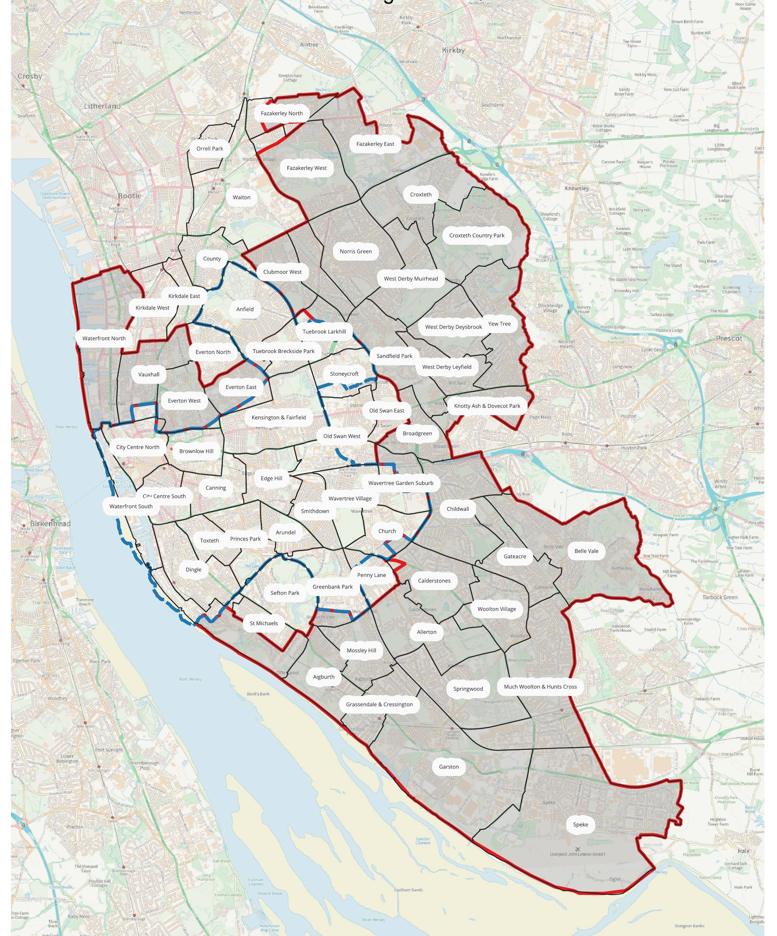
This is the council's own map from the Cabinet report Labour voted through. Drag to move around, or use + and −.
All 64 wards
Tap any ward to see it on the map.
Labour picked winners and losers. We'd protect everyone.
“Residents on one street now get a say on HMOs. One street over, it's a free-for-all.”Cllr Carl Cashman, Liverpool Liberal Democrats
Labour
Protection for some neighbourhoods. A corner of Tuebrook Larkhill, a sliver of Calderstones, a strip of Fazakerley. Aigburth, Garston, Speke, West Derby, Woolton and most of Everton West and Vauxhall get nothing.
Liberal Democrats
Called in Labour's decision and demanded an immediate Article 4 direction covering every ward in the city.
Labour's own report admitted other councils have protected their whole area at once and that the risks are relatively low. They still said no.
The numbers show what happens to streets left out. Small HMO conversions rose 57% outside the protected area in three years, against 15% inside it. Labour's patchwork pushes the problem onto the streets they didn't protect.
If the Liberal Democrats lead the council next May, we will bring in a city-wide Article 4 direction on day one. Every street, every ward.
What Article 4 means
- Without it, a family home can be turned into a small HMO for 3 to 6 unrelated sharers without planning permission. Neighbours get no say.
- With it, the owner has to apply for planning permission, so residents can object and the council must weigh up parking, bins, noise and the loss of family homes.
- HMOs for 7 or more people already need planning permission everywhere in Liverpool.
- Article 4 doesn't ban HMOs or affect ones that already exist.
Ward statuses come from Liverpool City Council's Cabinet report of 13 October 2026, which lists the 38 wards that fall wholly or partly outside the protected areas, and from its maps. Postcode results show every ward that shares your postcode district; if you're unsure which ward you're in, check the council's ward maps.